The West Coast of Puerto Rico is a region teeming with natural beauty, cultural history, and unique geographic features that captivate residents and visitors alike. From the tranquil mangroves of Boquerón Bay and the rugged limestone cliffs of Isabela to the iconic Cabo Rojo Lighthouse and its dramatic surroundings, the area is rich in ecological significance and historical charm. In this guide, we’ll explore the West Coast’s most remarkable features, from its biodiversity and breathtaking beaches to its cultural landmarks and conservation efforts, showcasing why this part of the island is truly one of a kind.
Key Takeaways
- The West Coast of Puerto Rico is a stunning blend of natural beauty, including mangroves, limestone cliffs, and pristine beaches, offering rich biodiversity and unique landmarks.
- Iconic sites like Boquerón Bay, the Cabo Rojo Lighthouse, and Isabela's limestone formations highlight the region's ecological and historical significance.
- The region’s cultural heritage, from Taíno petroglyphs to vibrant festivals, is deeply influenced by its diverse geography and local traditions.
- Sustainable tourism and conservation efforts are vital to preserving the West Coast’s unique ecosystems amid the challenges of climate change and development.
Understanding the Different Parts of Puerto Rico
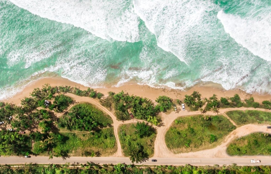
Image Source: discoverpuertorico.com
Before exploring the natural wonders of the West Coast, it’s helpful to understand how Puerto Rico is divided into distinctive regions, each with its own culture, landscapes, and tourism appeal. These different parts of Puerto Rico offer a diverse range of experiences, from mountain adventures to coastal escapes and vibrant city life.
Region | Key Highlights | Popular Municipalities |
|---|---|---|
Metro (San Juan Area) | Urban sophistication, historic landmarks, lively nightlife | San Juan, Bayamón, Guaynabo |
North (Porta Atlántico) | Karst landscapes, famous caves, and rich cultural sites | Arecibo, Manatí, Vega Baja |
West (Porta del Sol) | Surf culture, sunsets, and ecological reserves | Rincón, Aguadilla, Cabo Rojo |
Central Mountains (La Montaña) | Coffee farms, a cooler climate, and scenic hiking | Utuado, Jayuya, Adjuntas |
South (Porta Caribe) | Dry coastline, colonial architecture, fishing heritage | Ponce, Guayanilla, Yauco |
East (Porta Antillas) | Rainforests, island access, and hidden beaches | Fajardo, Humacao, Vieques, Culebra |
This regional breakdown provides a framework for exploring Puerto Rico. While the West Coast offers adventure and nature, the different parts of Puerto Rico together create a complete and culturally rich island experience.
Unique Geographic Features
The West Coast of Puerto Rico is a treasure trove of natural wonders and historical landmarks, showcasing the island’s diverse geography. From the serene mangroves of Boquerón Bay to the dramatic limestone cliffs of Isabela and the iconic Cabo Rojo Lighthouse, this region offers a blend of ecological significance and breathtaking beauty. These unique geographic features not only enhance Puerto Rico's appeal on the map but also highlight the island's rich biodiversity, geological heritage, and cultural history.
Coastal Lowlands of Puerto Rico (West Coast Context)
The coastal lowlands in Puerto Rico are broad, low-elevation plains fringing the island—most expansive on the north, with narrower but ecologically rich stretches along the west and south. On the West Coast, these plains host beaches, dunes, estuaries, mangroves, and coastal lagoons that support fisheries, protect shorelines, and anchor tourism. The coastal lowlands also shape local climate and land use: the west is generally warmer, drier than the north, and historically favored for agriculture and port towns.
Why it matters here: West Coast icons like Boquerón Bay’s mangroves, Isabela’s limestone rims, and the Cabo Rojo headlands sit at the meeting point of lowland plains, karst, and sea—bringing world-class scenery but also storm-surge, flooding, erosion, and sea-level rise considerations. Preserving dunes and mangroves is a practical defense for communities, infrastructure, and beaches.
Boquerón Bay and its Mangrove Forests
Boquerón Bay is recognized as one of the most ecologically vital areas in Puerto Rico. Spanning over 4,630 acres, the bay is enveloped by dense mangrove forests, which are critical for maintaining coastal biodiversity. These mangroves provide nesting grounds for over 20 species of migratory birds, including herons and sandpipers, and serve as nurseries for marine species like snappers and crabs.
The mangroves act as natural storm buffers, absorbing the impact of hurricanes and reducing coastal erosion. Boquerón Bay is part of the Boquerón State Forest, a protected area under Puerto Rican law to preserve its unique ecosystem. Eco-tours and kayaking adventures through the bay allow visitors to experience its pristine beauty while learning about the importance of mangroves in combating climate change.
The Limestone Cliffs and Caves of Isabela and Arecibo
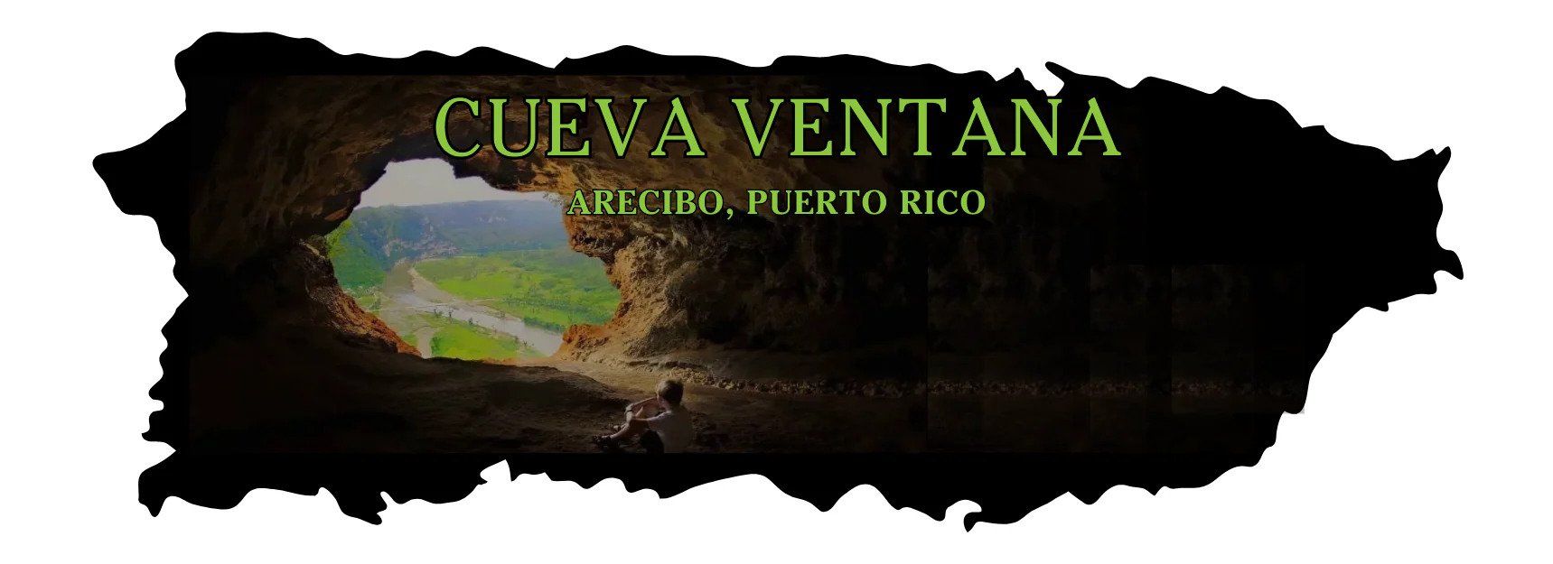
The limestone cliffs and caves of Isabela and Arecibo highlight the West Coast’s geological diversity, with formations like Cueva Ventana offering breathtaking views of the Río Grande de Arecibo valley. This natural marvel, aptly named “Window Cave,” is also a cultural landmark, featuring Taíno petroglyphs that provide a glimpse into Puerto Rico’s indigenous history. These caves are part of the Northern Karst Region, which plays a key role in replenishing the island’s aquifers.
In Isabela, the rugged coastline formed by these cliffs creates habitats for salt-tolerant plant species and other unique ecosystems. Beyond their ecological value, these formations are popular destinations for adventure seekers, attracting hikers, photographers, and history enthusiasts alike. The cliffs and caves embody a rich blend of natural beauty and cultural significance, making them must-see attractions on the island.
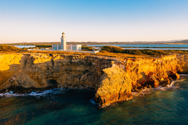
Cabo Rojo Lighthouse and its Dramatic Cliffside Location
Perched atop 200-foot cliffs, the Cabo Rojo Lighthouse (Faro Los Morrillos) overlooks the Caribbean Sea and the treacherous Mona Passage. Built-in 1882, this historic structure was designed by the Spanish to guide ships and is now a symbol of Puerto Rico’s maritime heritage. The surrounding cliffs offer panoramic views, making it one of the island’s most photographed landmarks.
The lighthouse sits within the Cabo Rojo National Wildlife Refuge, which spans over 1,836 acres and is home to 150 bird species, including the endangered yellow-shouldered blackbird. Visitors can also explore the nearby salt flats, which showcase a striking pinkish hue due to high salinity, and hike trails leading to scenic overlooks. This combination of history, ecology, and natural beauty makes Cabo Rojo Lighthouse a captivating destination for nature and history enthusiasts alike.
Coastal Geography: Beaches
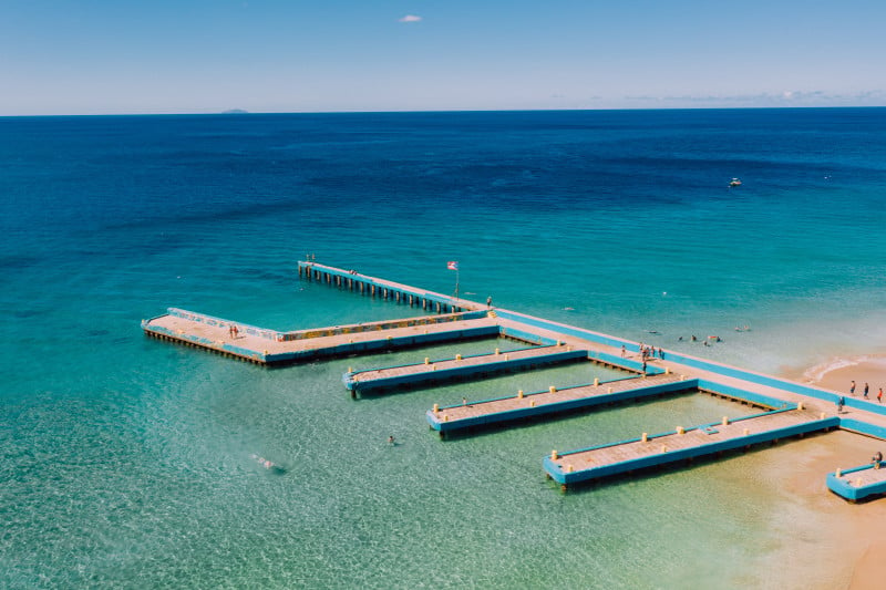
Image Source: discoverpuertorico.com
Top Beaches to Explore
The West Coast of Puerto Rico is home to some of the island’s most beautiful beaches, making it one of the most sought-after Puerto Rico areas for coastal getaways. Highlights include:
Beach | Why Visit? | Activities & Appeal |
Rincón | Renowned for its world-class surfing and breathtaking sunsets | Activities: Surfing, beachcombing, sunset watching Appeal: Perfect for surfing enthusiasts and couples seeking romantic seaside views. |
Aguadilla | Famous for family-friendly beaches like Crash Boat Beach, with crystal-clear waters and vibrant fishing boats. | Activities: Swimming, snorkeling, paddleboarding Appeal: Ideal for families and casual travelers looking for safe, scenic beach experiences. |
Isabela | Known for its natural beauty, excellent snorkeling spots, and surfing-friendly waves | Activities: Snorkeling, surfing, and hiking along coastal trails. Appeal: This area is great for adventure seekers and nature enthusiasts who want to explore marine life and unspoiled landscapes. |
Cabo Rojo | Home to Playa Sucia, a serene beach surrounded by dramatic cliffs and scenic views | Activities: Relaxing, photography, exploring the Cabo Rojo Lighthouse and salt flats. Appeal: This area is suitable for travelers seeking tranquility and stunning coastal scenery. |
Characteristics of West Coast Beaches
The West Coast’s beaches are diverse, ranging from sandy shores perfect for sunbathing to rocky coastlines ideal for surfing. Coral reefs thrive in the warm waters, creating opportunities for snorkeling and diving. These beaches also host marine wildlife, such as sea turtles and tropical fish, contributing to Puerto Rico’s rich biodiversity.
Bodies of Water That Surround Puerto Rico
Understanding what bodies of water surrounds Puerto Rico is essential to appreciating its climate, biodiversity, and coastal attractions. The island is bordered by two major bodies of water that shape its geography and marine life: the Atlantic Ocean to the north and the Caribbean Sea to the south and west.
Atlantic Ocean (North Coast)
This area features cooler, deeper waters and rougher surf, influencing cities like San Juan, Arecibo, and Isabela. It’s popular for surfing, deep-sea fishing, and shipping routes, but it is also prone to stronger currents and coastal erosion.Caribbean Sea (South and West)
Known for its calm, warm waters, the Caribbean surrounds areas like Cabo Rojo, Rincón, and La Parguera. These regions are rich in coral reefs and ideal for snorkeling, swimming, and eco-tourism.Mona Passage (West)
A deep marine channel between Puerto Rico and the Dominican Republic, the Mona Passage connects the Atlantic and Caribbean. It's important for whale migration and marine biodiversity, but also presents navigational challenges.Puerto Rico Trench
North of the island lies the deepest point in the Atlantic Ocean—the Puerto Rico Trench. At over 8,000 meters deep, it plays a vital role in seismic activity and tectonic plate movement, shaping the island’s northern landscape.
Overview of Water Bodies
Body of Water | Location | Key Features | Impact on Puerto Rico |
|---|---|---|---|
Atlantic Ocean | North Coast | Deep, cool, strong surf | Surfing, erosion, shipping |
Caribbean Sea | South & West | Warm, calm, coral reefs | Tourism, marine life, beach recreation |
Mona Passage | West of Island | Deep marine corridor | Whale migration, maritime navigation |
Puerto Rico Trench | North of Island | Deepest Atlantic point, tectonic zone | Earthquake activity, oceanographic significance |
These surrounding waters are vital to the island’s identity and ecosystem, making them a key part of understanding what body of water surrounds Puerto Rico and how it impacts daily life, tourism, and natural resilience.
Biodiversity of Marine Life
The marine ecosystems along the West Coast are teeming with life, from vibrant coral reefs to playful dolphins. Conservation efforts aim to protect this biodiversity, ensuring that future generations can enjoy the region’s natural wonders. The Puerto Rican climate, characterized by warm temperatures year-round, supports these thriving ecosystems.
Cultural and Historical Geography
Image Source: discoverpuertorico.com
Indigenous Taíno Influence
The Taíno people, the original inhabitants of Puerto Rico, left an indelible mark on the island’s geography and culture. Many place names, such as Mayagüez and Arecibo, derive from Taíno words, showcasing their deep connection to the land. The Taíno used the island's natural resources skillfully, creating tools from stone, shell, and wood, as evidenced by artifacts found in Cueva Ventana and other archaeological sites along the West Coast.
Petroglyphs and cave drawings, such as those found in Cueva del Indio near Arecibo, depict the Taíno’s spiritual beliefs and daily life. These artifacts reveal how geography shaped their settlements and rituals, with caves and rivers often playing central roles in their religious practices. Today, these sites provide a window into the Taíno’s way of life and are protected as part of Puerto Rico’s cultural heritage.
Role of Geography in Local Traditions and Festivals
The geographic diversity of Puerto Rico’s West Coast plays a pivotal role in its cultural traditions and festivals, reflecting how Puerto Rico’s geography continues to shape community identity and local customs. Coastal towns like Rincón host annual fishing tournaments and seafood festivals, celebrating their historical dependence on the sea. These events attract thousands of visitors and are vital to preserving the region's fishing culture.
Inland towns, such as San Sebastián, highlight the mountainous geography with events like the annual Fiestas Patronales, which include parades, live music, and artisan markets. These festivals not only honor the area’s natural beauty but also bring communities together to celebrate their heritage. The interplay of land and culture continues to shape the identity of the West Coast, drawing visitors eager to experience Puerto Rico’s vibrant traditions.
Sustainability and Environmental Concerns
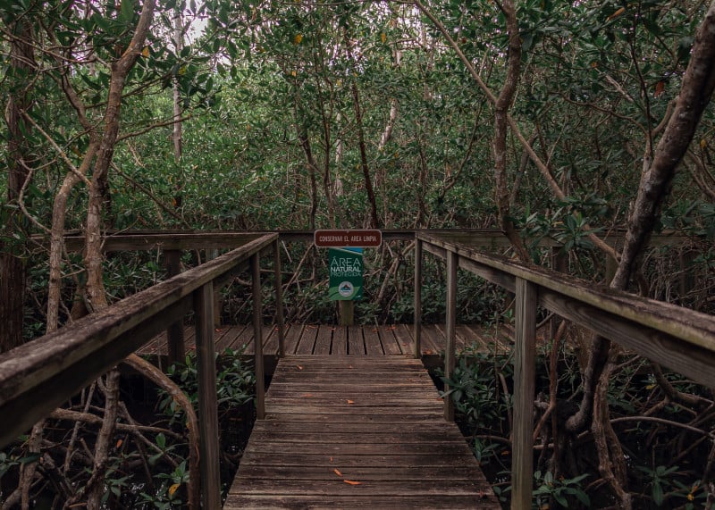
Image Source: discoverpuertorico.com
Preserving Unique Geography and Biodiversity
Efforts to protect the West Coast’s unique geography are gaining momentum. Organizations work to conserve mangrove forests, coral reefs, and wildlife habitats. Sustainable tourism initiatives encourage visitors to appreciate the region responsibly, minimizing their environmental impact.
Impact of Climate Change and Development
Global warming is increasingly affecting Puerto Rico's climate, with rising sea levels and stronger storms threatening coastal areas. Unchecked development further exacerbates these challenges, leading to habitat loss and erosion. Addressing these issues requires collaboration between local communities, governments, and conservation groups to ensure the West Coast remains a treasure for generations to come.
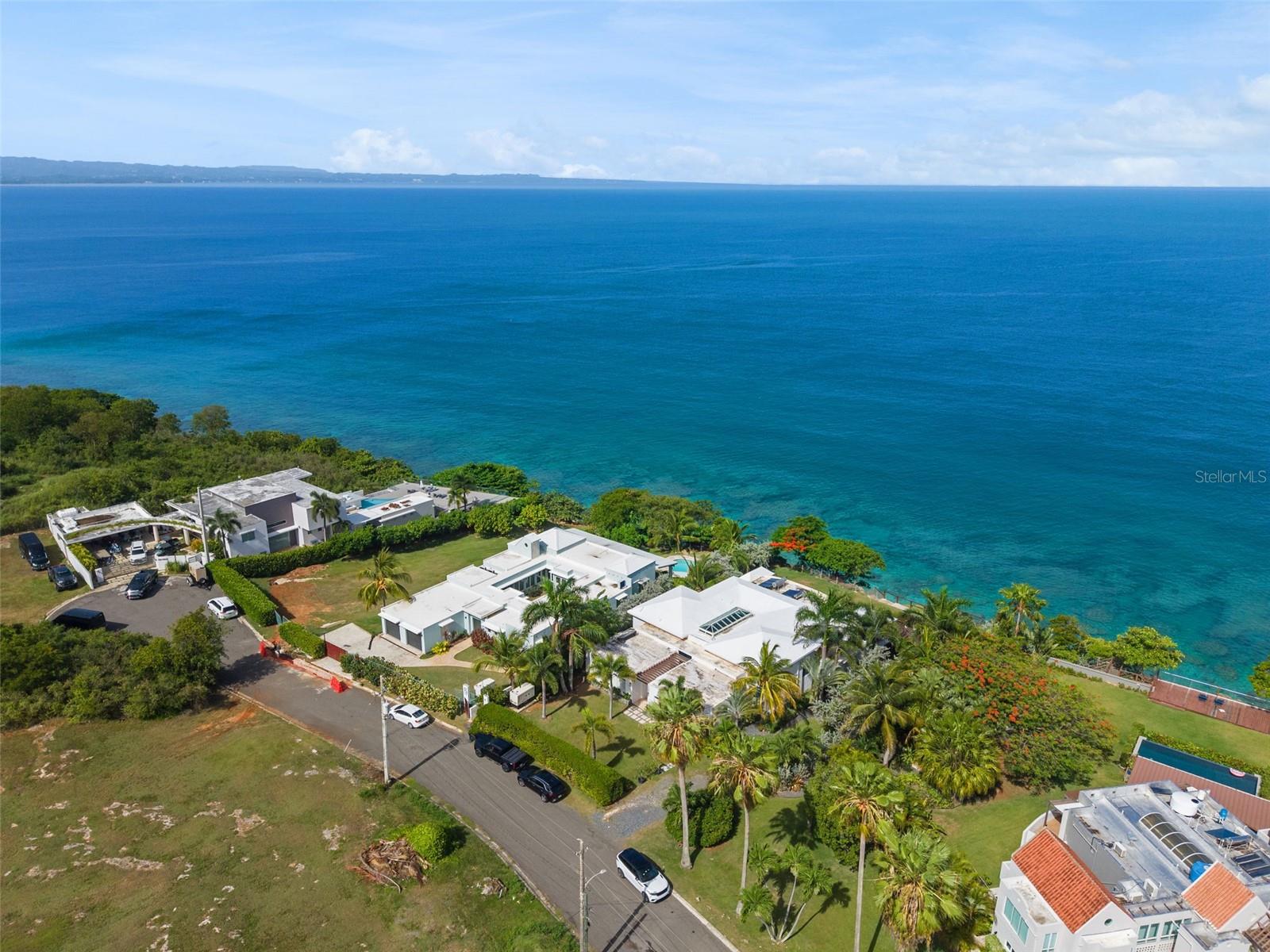
Luxury Properties and Houses for Sale in Puerto Rico
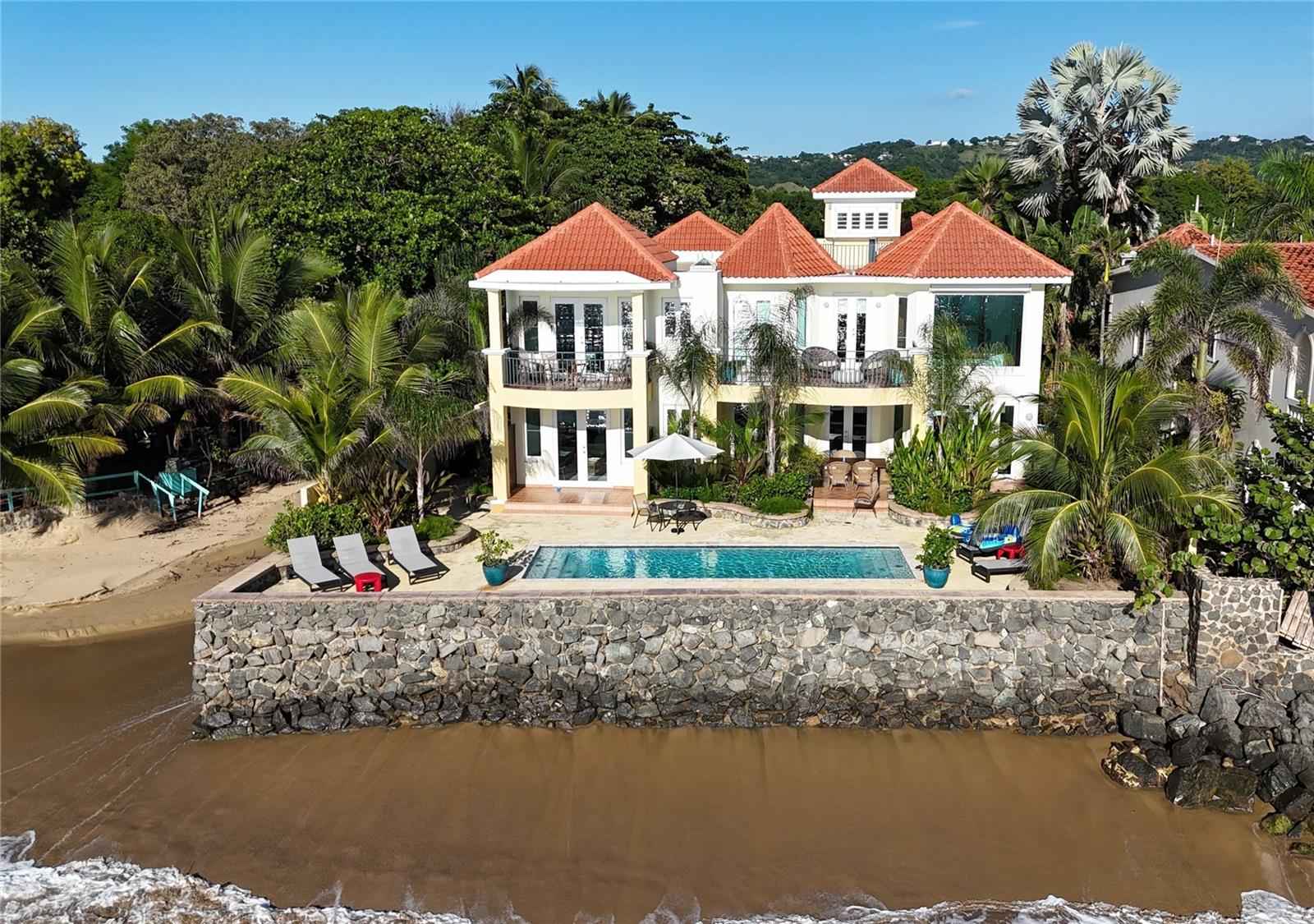
Luxury properties and houses for sale in Puerto Rico offer an unparalleled blend of natural beauty, cultural richness, and modern living, perfectly showcased through Christie's International Real Estate Puerto Rico. From elegant coastal estates near the pristine beaches of Rincón and Isabela to refined homes surrounded by the lush landscapes of Cabo Rojo, each property reflects the island's unique charm. With access to exclusive neighborhoods across Puerto Rico, your dream luxury house for sale awaits in a setting that promises both tranquility and sophistication.
Lot 4 IBIZA ST, RD 107 KM 2.7 AGUADILLA PR, 00603
13 CARR 429 RINCON PR, 00677
A rare beachfront Rincon villa on Corcega Beach with three elegant units, direct beach access, ocean views, a pool, and strong luxury rental potential.
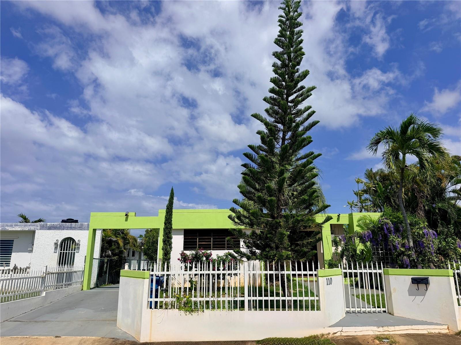
110 GRUBB DRIVE, AGUADILLA, PR 00603
A furnished 4-bedroom Base Ramey home in Aguadilla offering backup power, solar, prime convenience, and strong residential or rental investment potential.

57 QUINTAS DE SANTA MARIA II MAYAGUEZ PR, 00680
Casa Aurelia is a custom architectural estate on Puerto Rico’s west side, offering expansive private living, designer interiors, resort-style outdoor amenities, and secure modern luxury.
Conclusion
The West Coast of Puerto Rico is a special place, full of natural beauty, history, and opportunities for adventure. With its peaceful mangroves, stunning cliffs, and gorgeous beaches, it’s easy to see why this area is so loved. If you’re drawn to its rich culture, unique landmarks, or the chance to be part of a vibrant community, the West Coast has so much to offer.
At Christie's International Real Estate Puerto Rico, we are your trusted partner in buying, selling, or renting luxury properties across the island, including the breathtaking West Coast. Our expert team is committed to guiding you through every step of the process, ensuring a seamless and personalized experience. Visit our website to explore our exclusive listings or contact us today to turn your real estate vision into reality.
FAQs
What is the geography of Puerto Rico?
The geography of the island of Puerto Rico includes the main island, the smaller islands of Vieques and Culebra, and diverse landscapes like the Cordillera Central mountain range and coastal plains on the north coast and south coast. Surrounded by the Atlantic Ocean and the Caribbean Sea, Puerto Rico is part of the Greater Antilles, located near the Virgin Islands and the Dominican Republic. Key features include Cerro de Punta, the island’s highest peak, and El Yunque National Forest in the Sierra de Luquillo, with rivers like La Plata and Grande de Añasco completing its natural beauty.
What is the nature and environment of Puerto Rico?
Puerto Rico's environment is a vibrant mix of lush vegetation, tropical rainforests, and diverse wildlife, such as the Puerto Rican parrot. The island spans from the coastal plains of the south coast to the rainforests of the Sierra de Luquillo, including El Yunque National Forest. Nearby islands like Vieques and Culebra, as well as the Virgin Islands, are known for their pristine beaches and marine biodiversity. As part of the U.S., Puerto Rico's natural and cultural heritage reflects a blend of influences from the Caribbean and the Americas.
How many beaches are on the West Coast of Puerto Rico?
The West Coast of the island of Puerto Rico boasts countless beaches, including those near Ponce, Loíza, and the mouth of the Grande de Añasco. From the serene Playa Sucia in Cabo Rojo to the lively Crash Boat Beach in Aguadilla, these beaches offer views of the Atlantic Ocean and the Caribbean Sea. As a neighbor to the Virgin Islands and Dominican Republic, Puerto Rico’s coastal plains and vibrant vegetation create a haven for beach enthusiasts.
Is Puerto Rico in the mountains?
Yes, Puerto Rico is mountainous, with the Cordillera Central running east to west across the island. This range, which includes Cerro de Punta, the highest peak, extends to the Sierra de Luquillo, home to El Yunque National Forest. The island’s mountainous terrain is surrounded by coastal plains, with rivers like La Plata and Grande de Añasco providing essential water sources for Puerto Ricans and sustaining diverse vegetation.
How were the mountains formed in Puerto Rico?
The mountains of Puerto Rico, including the Cordillera Central and the Sierra de Luquillo, were formed by tectonic activity between the North American and Caribbean plates. This activity shaped the rugged terrain of the island of Puerto Rico, creating peaks like Cerro de Punta. Over time, the Puerto Rico Trench near the Virgin Islands, along with rivers like La Plata and Grande de Añasco, further influenced the mountains, contributing to the island’s lush vegetation and unique ecosystems. Puerto Rico shares geological and cultural connections with the Dominican Republic and the U.S., adding to its distinctive identity.